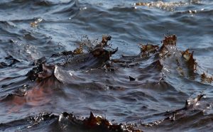
Increasing Situational Awareness of Conflict Linked Oil Pollution with VHR Satellite Imagery
Very High Resolution (VHR) satellite imagery is often used as a source of truth to
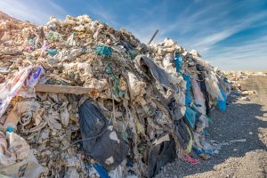
Combing VHR Satellite Imagery and Deep Learning to Detect Landfills
Satellite imagery and remote sensing has been used extensively for monitoring land usage and land
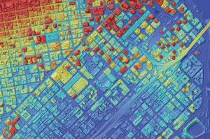
Expanding Product Offering: AW3D
European Space Imaging is expanding our elevation product offering with the addition of AW3D, a
Discover
What's
NEW
FIND WHAT YOU'RE LOOKING FOR
Resource Type
Industry
Application
Keyne Eye: Smart Urban Planning
Milton Keynes is one of the fastest growing cities in the UK and a great economic success story. However, the challenge of supporting sustainable growth without exceeding the capacity of the infrastructure, and whilst meeting key carbon reduction targets, is a major one. In 2013, Milton Keynes collaborated with European
Keyne Eye: Smart Urban Planning
Milton Keynes collaborated with European Space Imaging partner Satellite Applications Catapult, to investigate whether a more effective method could be found to detect changes to land over time, ensuring that planning management policies were adhered to. Milton Keynes is one of the fastest growing cities in the UK and a
Large-scale Mapping: 7 Important Factors to Consider When Choosing Between Aerial and Satellite Sensors
Member states and regional mapping agencies are often split on preferring aerial or satellite datasets. Which one is better? Users should carefully compare the two platforms to ensure the best data collection for their project. While a combined approach using satellite imagery to fill missing aerial data gaps can be effective, many organisations at both EU and national levels depend solely on VHR satellite data for successful wide area coverage. Here are 7 major factors to consider.
Leveraging Artificial Intelligence To Create Global HD Vector Maps
Ecopia Global Feature Extraction (GFX) Powered by European Space Imaging is a unique partnership that utilises the freshest, highest quality satellite imagery along with the most advanced artificial intelligence from Ecopia.AI (Ecopia) to offer accurate geospatial feature extraction at continent-wide scale. It takes away the challenge of obtaining up to
Major Oil Spill in the Mediterranean
French and Italian maritime authorities have commenced cleaning a major spill that has spread 20 kilometers in the Mediterranean Sea after two cargo ships collided north of the island of Corsica on Monday 8 October 2018. European Space Imaging captured a series of satellite images of the site on Tuesday