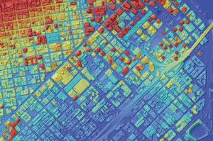
Discover
What's

NEW

FIND WHAT YOU'RE LOOKING FOR

Resource Type

Industry

Application

Managing Solar Energy with Satellite Based Earth Observation

While Russia remains in conflict with Ukraine, and the future of the Russian oil and gas supply is uncertain, the EU is now faced with the challenge to reduce its energy dependence on Russia, requiring a backup plan for its energy efficiency. It is widely known that the EU has

Mapping Landslides with VHR Satellite Imagery

Copernicus Emergency Management Service is using Very High Resolution (VHR) satellite imagery supplied by European Space Imaging to create grading maps and analyse damage after landslides in Germany. A former mining region in Saxony, Germany, has experienced numerous landslides since September 2018. After two major incidents in March and April

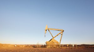
Mapping Methane with VHR SWIR Imagery

Methane is the second most important greenhouse gas and its concentration in the atmosphere is
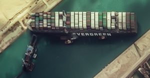
 currently increasing at a rate of around 1% per year. Whilst not as prevalent in our atmosphere as carbon dioxide, methane gas emissions threaten a more severe impact on global warming. Therefore, monitoring and controlling